Papamoa Hills
About 6 weeks ago, on an overcast and drizzly day, I joined my tramping club for a morning walk up Mauao (Mt. Maunganui) and then an afternoon one on the Papamoa Hills. Because of an appointment, I had to bail partway through the afternoon and didn't do the hills justice. This time I was passing by on my way up for my brother-in-law's birthday, so stopped for a better look. This post will contain a mix of photos from both visits.
The Papamoa Hills are Northwest of Te Puke and Southwest of Papamoa. They are the site of numerous Maori Pas, which would have had dominating views, and plenty of forewarning, of any approaching enemies from the sea.
It was just after 8 a.m. on a Friday, and I was surprised by the number of cars, and obviously people, there. I thought most people would have been either at work, or still in bed.


A few hens and at least one rooster seem to live near the signs at the edge of the carpark, as I'd seen them there both times.


The signs indicated a number of tracks that can be walked, however the main route is essentially one big circle, which I did clockwise on this second occasion. The track leads steadily uphill for, most of, the first 700 metres until it comes to a junction of paths, passing by some benches for those that are in need of a rest while climbing.


The previous time here the group, and I, kept to the lower section by heading straight on at the junction, but this time I turned left and continued up toward the trig point, winding my way up the path.


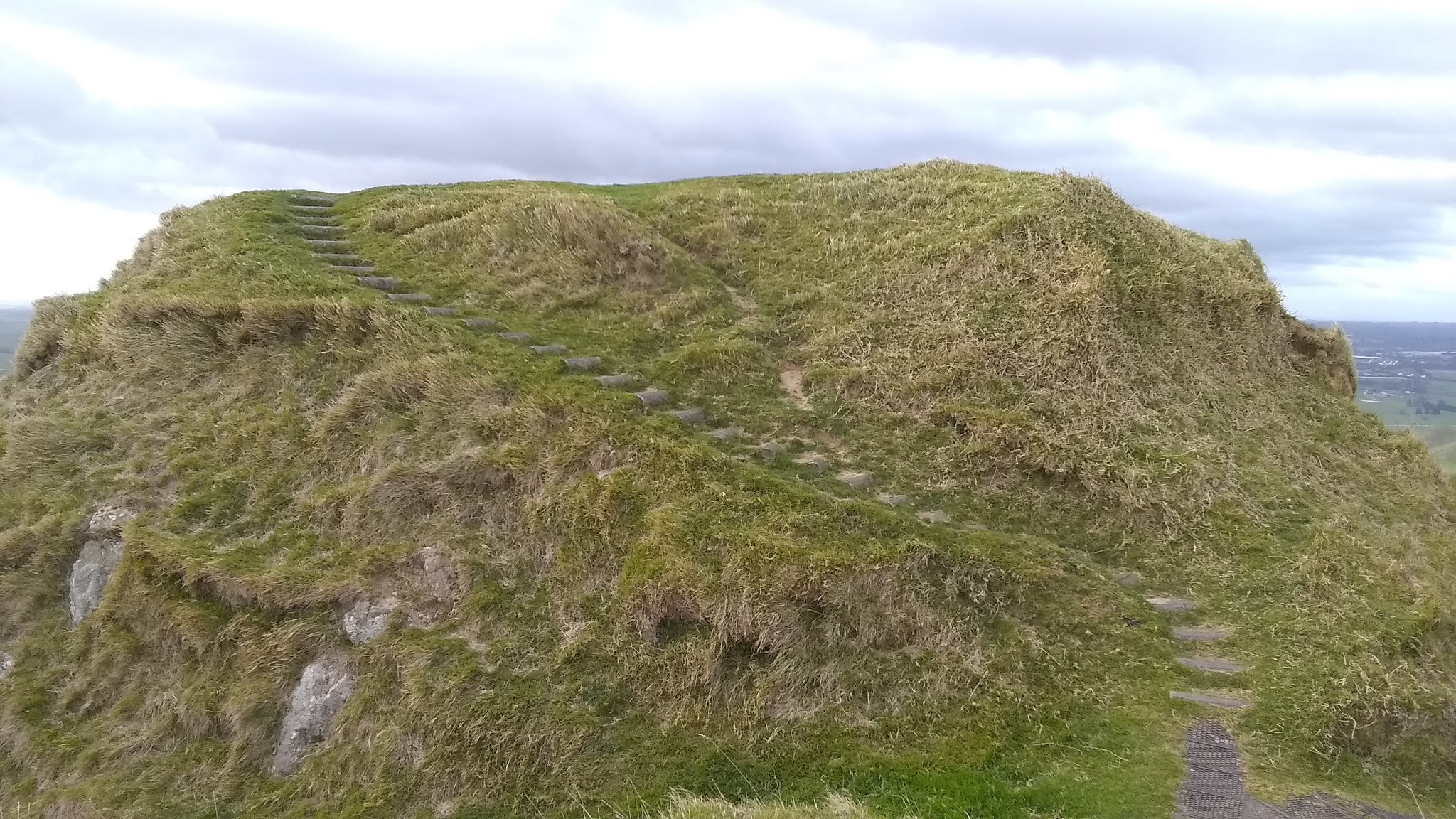
At the summit I reached the first of the Pa sites. Although the skies were clear above, I could see rain pouring from the sky further south and, once at the top, I experienced very strong winds.


Also, from the top, I could now see down to the ugly scar that was the quarry.

I wandered across the flat top of the hill, wondering if all of that levelling had been done by hand, or if some was natural.


There were a number of people jogging up to the top and then back down, mostly women. I found more benches, this time clustered together.


I headed north, away from the crowds, along a ridge, passing an antenna structure, toward the second Pa site.


There was a small group of wild turkeys under a tree. I didn't linger, and thereby didn't pay attention to the shape of the ground at this site, but I did marvel at the roots of a tree that had likely been exposed by the high winds that must be common up here. There is no sense of scale, but these roots were taller than me.


A short walk down from there I encountered a group of steers loitering beside a fence I wanted to cross. Then up a short step accent onto the flat of the third site, where I surprised a young lamb and two ewes.


I could see the fourth site, the one I visited with the tramping club last time, from up here.

I retraced my steps then walked down the farm track to the point where I had left the tramping group on my previous visit.


As we had walked straight across to the fourth Pa site on that day, I did not bother to revisit it today, but the following is a picture looking up from that site when I was here with the tramping club.


Not long after I arrived back at the carpark, after having walked 5.5km around the loop in about 80 minutes.


Comments
Post a Comment