Shropshire Hills 2013 Day 1
Day 1 Tuesday 20th August 2013
My plan (which according to Janet, the B&B
owner, was somewhat ambitious), was to walk over to the Stiperstones and
back. Said Stiperstones are a setting in
a few of the novels by Malcolm Saville novels.
The B&B, Highcliffe (sadly now no longer owned and operated by Janet
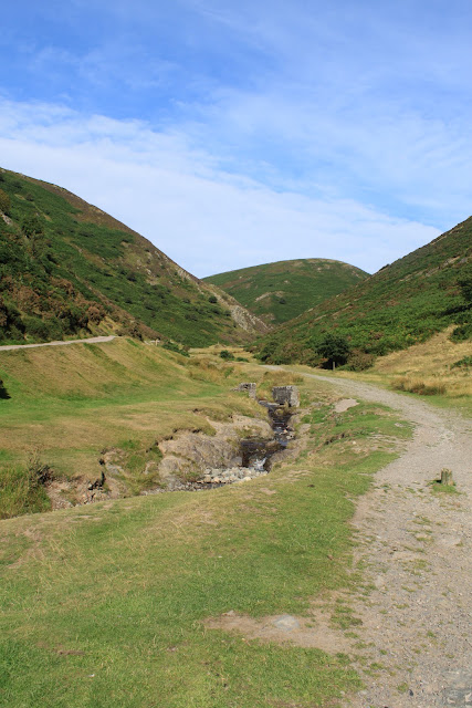
and David), was situated ideally for walking up the Carding Mill Valley.
Part way up, I took a short detour to the left to visit the Light Spout Waterfall.
There is a path beyond the waterfall but, on this particular day, I could not see how to access it (although, 6 years later I walked the opposite way and climbed down the side of the waterfall, so now I know where it goes). Returning to the Carding Mill valley, I turned left to begin the steeper ascent up onto the Long Mynd.
Reaching Mott’s Road at the top, I saw a sign to the Stiperstones and Bridges pointing to the right (which seemed wrong to me, but I followed it anyway). A while further on the path branched, and a left turn onto a narrow tarmac lane took me down past Wildermere Pool (where wild ponies sometimes stop to drink, and there was on this occasion).
Then it was off the lane and up and over a broad hill, coming down through fields to reach another lane, where a left turn led me through Ratlinghope. Shortly after, I left the road again to take a detour alongside a stream, part of the Shropshire Way (a walk that, at the time, I thought meandered and looped all over Shropshire, sometimes splitting and going off in multiple directions). I rejoined the road for the walk into Bridges (essentially just a youth hostel and a pub). It was here that I made a major navigational error.
On the map, I could see that I had to turn
left up a road and then, a little while later, turn right off that road. Unfortunately, I turned left up the wrong road
(I turned by the pub but did not notice on the map that there was another road
turning left a little past the pub, which was the road I should have taken). It was a pleasant walk, up a narrow country
lane passing by a derelict overgrown barn (I wandered along this lane again in
2019 for a different reason). I came
across a footpath sign pointing right (labelled Shropshire Way), which I took
as the turn I should be making. I followed
a rough path through fields, sometimes a bit muddy underfoot, following signs
for the Adstone way, but eventually I found there was no longer a marked path. Bull-headed, I marched on, crossing fences
sans stiles. Finally I saw a chap
cutting his hedge, so stopped to ask where I was. Apparently I had been heading south, when I
should have been going north-west. Oops.
I walked out to the road beside the chap’s
house, and decided to follow roads from now on for a while so as to not get
lost again. I walked past Kinnerton Farm
accompanied by a pesky cloud of flies that buzzed around my head and face all
the way up the road. Looking at the map,
I decided to follow another path from Knoll’s Cottage up to Nipstone Rock, but
the path soon turned into a steep scramble up through fields and over fences
with no gates. Off route again.
Shortly afterward I saw Nipstone Rock, and
then found the Shropshire Way yet again, so followed that up to a road (where
if I’d turned left, I could have gone to the Bog Visitor’s Centre) which I
crossed into the Stiperstones National Nature Reserve.
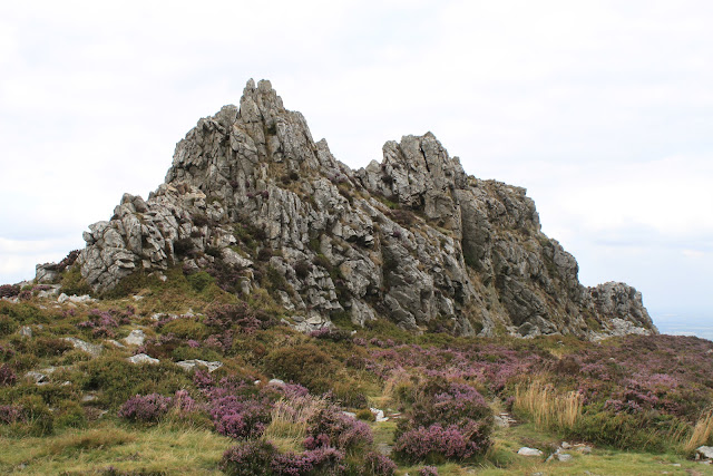
Clambering along lines of rocky white stones amongst the heather, I finally came across Cranberry Rock, then Manstone Rock, and finally the Devil’s Chair. Strangely, I didn’t linger (which in hindsight I realise I do a lot, then later regret not mentally immersing myself in the landscape).
Clambering along lines of rocky white stones amongst the heather, I finally came across Cranberry Rock, then Manstone Rock, and finally the Devil’s Chair. Strangely, I didn’t linger (which in hindsight I realise I do a lot, then later regret not mentally immersing myself in the landscape).
I wound my way down back to Bridges (I don’t
recall which route I took now, as I am typing this up over 6 years later, and I
have walked to the Stiperstones 3 or 4 more times since). At the pub I had a cider, which was the
cheapest so far this trip at £2.90 (how quickly prices went up over the next 5
years). On the return route, I began by
following the road up onto the Mynd, but near Belmore Farm I took a path that curved
away and brought me back up to Mott’s Road, so I knew roughly where I was. Back down Carding Mill Valley again, I took
another short detour up to the Reservoir (which I later learn was the
inspiration for Hatchholt in the Lone Pine books).
In Church Stretton I stopped at a café that
sold ice cream, and purchased one. After
that it was to the co-op for a 10-pack of cider, then back to the chippy for
more fish ‘n’ chips to eat in Rectory Field once again (this time washed down
with cider). Om, nom, nom!


Comments
Post a Comment