Ryk's Loop: 15km around Katikati
This is a walk in and around Katikati that I have done a number of times, and I must admit I like it because I can do it right from my parent's place, it is pretty much flat (which makes it great for initial training for more rigorous walks) and it is reasonably long (and can be done twice in a row if one wants a full day's walking). It encompasses (optionally the Haiku Walkway), the Uretara Landing Reserve, the Uretara Estuary Walk, the Yeoman Walkway (through the Levley Lane Reserve, the Francis Drive Esplanade Reserve, and the Park Road Reserve), the Preston Drive Esplanade Reserve, the MacMillan Reserve, the Tamawhariua Reserve/Foreshore Walkway, the Gilfillan Drive Rec Reserve, and the Vessey Stuart Recreation Reserve (hopefully I got them all).

In the image above, the start/finish is the black X, the optional walk through the Haiku Walkway is in red, and the main route is in green.
Into the second month of autumn, with the day a bit cooler (but still in the mid 20s) and back in Katikati for the Easter long weekend, and recently cognisant of how much weight I'd gained over the past approximate 15 months, I decided to walk this route again. Because of my like for this route, I've decided to name it after myself. LOL!
I've blogged about a section of this walk before, so I'll link to that when appropriate below. I'll also write this as if starting from a location where there is plenty of free parking (which is a short distance from my parent's house, so is essentially the same route). I'll also mention an optional additional walk that can be done at the beginning to extend this walk by about a kilometre.
Starting at the Dave Hume pool (the black X in the image above), behind the Carisbrooke Bible Chapel at the intersection of Jocelyn Street and Carisbrooke Street, head back out to the street and turn right.

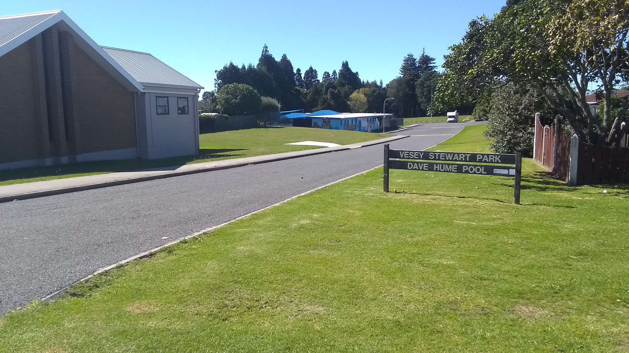 |
| The entrance to the Dave Hume pool carpark |

Optional Extra (that requires crossing the main road twice, and is in red in the image above): If you would like to tack on the Haiku Walkway at this point, head left down Jocelyn Street, turn left at the Main Road and then cross over the main road. Between the Robert Harris coffee shop to the left, and the Hammer Hardware is a narrow laneway down to the park below. You will see a pedestrian bridge across the stream ahead of you. Make your way over to it, and cross to the other side: feel free to explore the haikus on this side of the stream first if you wish. Turn right at the far bank and continue all the way along until you intersect with the main road. At the main road turn right, immediately cross the bridge, and then immediately take the path to the left, away from the road, following the other bank of the stream to join back with the route at the point mentioned in the next paragraph.
If not taking the Haiku path detour mentioned above, continue straight along Carisbrooke Street to the junction at Beach Road. Turn left to head down the hill and, at the bottom, turn right into Noble Johnston Drive (where the aforementioned Haiku path detour rejoins our route), sticking to the footpath on the left of the road (between the road and the stream). Bear in mind that this is a shared path with cyclists from here for some way along the estuary (until the exit at Binnie Road I believe). A short distance up Noble Johnston Drive (just before the houses), the route leaves the roadside, going left and dropping to follow along the stream bank.
For photos and some information on the section of the walking route from here along the Uretara Estuary and Yeoman Walkway (that takes you as far as the Park Road Reserve) see my previous blog here.
One thing I was glad of this particular morning was that all of the dog owners along this stretch had their dogs on a lead/leash. One thing I was not glad of was the "evidence" that had not been bagged and taken away.
The Uretara Estuary Path follows the bank of the Uretara Stream out to where it flows into the Estuary (remember to follow the turn left along the foreshore at the junction where the path splits and the right path goes inland to Binnie Road). From here the path runs through along a winding grassy corridor through a number of reserves at the backs of properties that are lucky enough to have views looking out over the estuary.

Eventually that reserve opens out into the Park Road Reserve park situated at the end of Park Road. The photo above shows a latter part of that path that has been upgraded (but is less aesthetic than previous).

Crossing the park veering slightly to the right takes you over a small rise to drop down to the newer extension that follows the water's edge (not that you would know, considering it is obscured by numerous mangroves) around behind the Summerset complex.

The path then continues behind a few houses before circling inward and to the residential roads. A quick right, left, left brings one out to Park Road and heading back toward town. From here it is about a kilometre's walk along the footpath beside the road.


At the Polley Crescent junction one can optionally continue straight along Park Road for another block to the intersection with Beach Road, and a handy dairy if one thinks they deserve some refreshment this early into the walk (realising there will be no more opportunities to purchase food/drink until the end), and they want to contend with the students wandering out of the school opposite. I, however, usually turn left into Polley Crescent, where the concrete underfoot disappears temporarily if you keep on the left side of the road. Polley Crescent dog-legs around to the right and joins Beach Road a little further along.


Another left onto Beach Road has you heading out of town (past the last few houses and on the last of the pavement for some time and into the more dangerous 80km/hr traffic area). The grass verge is very wide, and offers one a safe area well away from the road to walk. Head all of the way along until just before the bend in the road.


Take a further turn left onto Pukekura Road, and follow it all of the way around another dog-leg to the right, all of the way to the end of the road. Here you will see a grassy path on the right heading out to the harbour's edge. At this point I encountered the only off-leash dog of the walk (so my ire only surfaced this one time briefly).


From here, make the (only) turn right to walk the grassy strip known as MacMillan Reserve. You might encounter a few people walking around here (having parked at the car park a little way ahead).


Passing the car park (and toilets) on the right, head straight across the end of Beach Road (past the boat ramp on the left) and into the Tamawhariua Reserve/Foreshore Walkway.


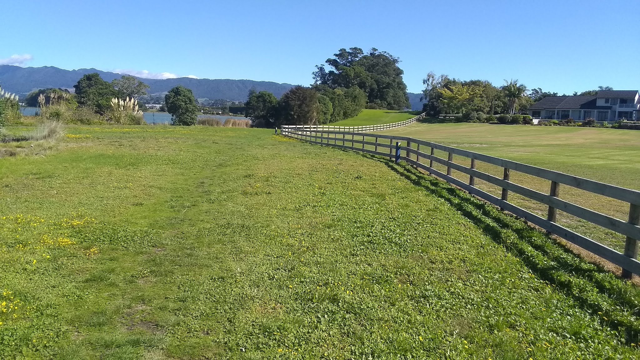
This section had me remembering some of my U.K. walks (especially the Ridgeway, and the third day of the Wye Valley Walk), with the blue skies, and the remnants of haymaking (I believe) in the field.

For a distance, the path here follows the arc of the harbour's shore, mostly along a crushed stone track that seemed upgraded since my last time here. I'll let the pictures tell the story for a bit.


I had had some doubts about being able to navigate past a drain that runs out into the harbour further along, as in the past there had been a low, narrow, boardwalk-style bridge right on the beach across the drain, and each time I had done this walk, in the past, that bridge had been in progressively worse states of disrepair - so much so that the last time I recall it was half submerged and almost on one side, obviously the victim of the tides (I had to precariously balance along the higher edge of the bridge, and then leap over a stretch of emptiness to the other side of the drain on that occasion). Luckily, today, I saw with some relief that the entire area had been redesigned with a larger, wider bridge that looked as though it would last for some decades to come. I looked over the side at the point where tide and culvert met, imagining I could almost make out part of the old bridge submerged under the slimy weed there.


The crushed stone path ended as I passed over another, smaller, bridge, and I was back on a wide grassy stretch once again. The "steepest" ascent of the day was encountered, forcing me to gain a few metres more height above sea level. Despite my sarcasm, I did feel the burn in my thighs for the first time today as I crested that minor rise.


 |
| My biggest ascent of the day (probably) in the background. |


 |
| Looking back along the trail, down the "huge" slope. |
I would love to own one of the houses situated along this stretch, but equally would likely hate the walkers and cyclists that ventured off the designated walking area and on to the front lawn, as in many places there is nothing to differentiate between them, other than the tiny sign in one of the following photos.


Here the route leaves the water (to return briefly much later), and heads right inland (down a dip to the left in the following photo, and not on to someone's lawn) along a permissible path amongst the shadow of trees.


Along the left are numerous flax plants, and then huge mounds of, what in England would be called, brambles: masses of overgrown blackberries. A few young gorse bushes were there also which, with the brambles, reminded me again of some of my U.K. walks.


Shortly after that, the path follows alongside a couple of rows of shelter (trees) and all too soon I was back intersecting with Beach Road, at a point within sight of the end of the road and the boat ramp I had passed not that long ago. A sharp turn left and once again I was walking the grassy verge along the roadside.


It is about a kilometre's walk beside the road along this section, passing the junction where I earlier turned into Pukekura Road, before I came to my next turn; another left into Prospect Drive.


I passed the pack house and cool store and I was glad it was Good Friday, as it was already into kiwifruit picking season, and had it not been a public holiday this area would have been bustling with activity and large trucks heading in and out.
At the sharp bend in the road, one needs to head straight ahead to just inside the entrance to the sewer works, then take a hard right along the side of the kiwifruit vines. However, if the orchard has been recently sprayed (check the sign as you arrive) you can not pass through; in such a situation you would alternatively have to retrace your steps back to Beach Road, and continue toward town then turn left into Wills Road instead.


Following along the edge of the kiwifruit block, you then turn left at the end to follow the track leading to the edge of the harbour (although the water is only glimpsed through gaps in the flax bushes along the path's edge). A right here turns you in the correct direction (I once was walking the opposite way and did not know to turn inland here, and ended up right in the sewage works).


Once again you are walking along the back of a number of properties, and if one does not keep a careful eye out, you might accidentally veer into one of them, especially if you do not notice the steps heading down toward the left into the short section of bush clad trail in the following photo.


All too soon we are walking the little boardwalk to arrive at Wills Road (if the orchard three paragraphs previous was closed for spraying, this is where the alternate route would rejoin the main one). Veer slightly right across the road and onto the concrete path across the grass below the houses.

 |
| Looking back along the trail after walking the boardwalk. |

Just before Gilfillan Drive, ignore the left branch of the fork in the path (that would take you to Robinson Street, at the end of which is a short access way into the back of Moore Park, the football and rugby grounds), and instead cross over Gilfillan Drive and enter the Kai Walkway - a section where a variety of fruit trees have been planted and anyone can help themselves if any fruit is in season. Luckily for me it was right in the midst of feijoa harvest season, so I stopped and grabbed 10 or 20 that were laying on the ground (a sure sign they were ripe).


Continuing straight (assuming you were not diverted by fruit, as I was on this occasion) directly cross over Fairview Road and drop into the grassy strip with the path following a drainage culvert between houses. This section meanders a little, and becomes shady beneath the trees. Eventually the path forks (the right one takes you up to the school grounds) at which point you turn left and come out right behind the Dave Hume Pool carpark where I suggested one start this walk. Here, I noticed an unusual type of graffiti, sprayed on the grass with fluorescent paint.


I made my way back to my parent's house, to arrive 2 hours and 48 minutes after I left - not quite the 6km/hour speed I expected to have achieved. I blame the stop to collect feijoas (and the numerous stops to take photos).


Comments
Post a Comment